

You can find on this page the Melbourne topographic map to print and to download in PDF. The Melbourne elevation map present the topography, river and relief of Melbourne in Victoria - Australia.
The Melbourne topographic map shows elevation, hills and landforms in Melbourne. This elevation map of Melbourne will allow you to know topography, river and relief of Melbourne in Victoria - Australia. The Melbourne topographic map is downloadable in PDF, printable and free.
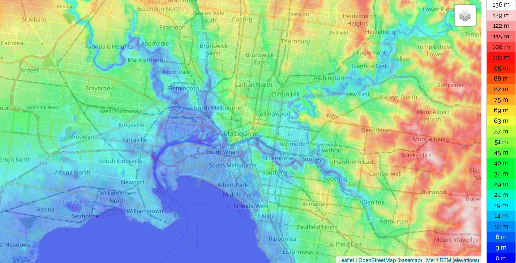
The City of Melbourne municipality is located at latitude 37 degrees 49 minutes south and longitude 144 degrees 58 minutes east on the south-east edge of Australia. Focused around a central business district, metropolitan Melbourne suburbs spread more than 40 km to the south, are hemmed in by the Dandenong ranges 30 km to the east, extend up to 20 km to the north and sprawl across vast, flat basalt plains to the west. Victoria contains many topographically, geologically and climatically diverse areas, ranging from the wet, temperate climate of Gippsland in the southeast to the snow-covered Victorian alpine areas which rise to almost 2,000 m (6,600 ft), with Mount Bogong the highest elevation peak at 1,986 m (6,516 ft) as its shown in Melbourne elevation map.
Mount Bogong, highest peak (6,516 feet [1,986 m]) of Victoria, Australia as you can see in Melbourne elevation map. It is in the Australian Alps, 150 miles (240 km) northeast of Melbourne. Well known for winter sports, the peak derived its name from an Aboriginal word meaning “high plains.” Bogong township was established there during the construction of the Kiewa Hydro-Electric Scheme (completed 1958), near Albury. Melbourne varies in altitude/elevation from about 2 m (highlight point) to 68 m (highlight point) above sea level.
At 137.3 m above sea level, Mount Cooper in Bundoora is the highest point in inner metropolitan Melbourne. Aside from higher peaks in the Dandenong Ranges, other eminences in the greater metropolitan region are located on the Mornington Peninsula (for example, Arthurs Seat, 216 m; Mount Martha, 160 m), in Melton City (Mount Kororoit, 237 m; Mount Atkinson, 140 m) and Hume City (Mount Ridley, 289 m; Gellibrand Hill, 204 m) as its mentioned in Melbourne elevation map. The slopes of Mount Cooper are the location of a children park and fauna park, picnic areas, wetlands and the Coopers Settlement Heritage Village. The homestead of racing identity and horse breeder John M.V. Smith was built in 1899-1900, and features outstanding stained glass work and other building decoration. After use as the Repatriation Mental Hospital from 1924 and as a day hospital from 1968 until decommissioned in 1993, the mansion was restored and opened in 2001 as the Bundoora Homestead Arts Centre.